


釣果を増やす。魚がついている境目を見つけよう。
水温のコンターラインを描く唯一のフィッシングアプリ。境目が一目でわかる。リアルタイム AIS、7 日間再生、競合より圧倒的に安い料金 — $9.99/月から。
CATALYSST is real-time fishing intelligence — a blend of catalyst and SST (sea surface temperature).
Yes — spelled with a double S, on purpose. Not the word “catalyst.” Catalysst overlays live AIS vessel traffic with satellite sea surface temperature and chlorophyll charts, so you leave the dock knowing where the fish are — not where they were.
Real-time vessel traffic. Real catch data. Where the fish actually are.
Other apps show you yesterday's satellite gradient. We show you the temperature break, the vessel traffic on it, and 7 days of how it moved — so you leave the dock knowing where to go.
他のアプリでは組み合わせられない 5 つのツール。
すべての機能は、より早く魚にたどり着くために存在します — Hilton’s、FishDope、FishTrack の数分の一の価格で。
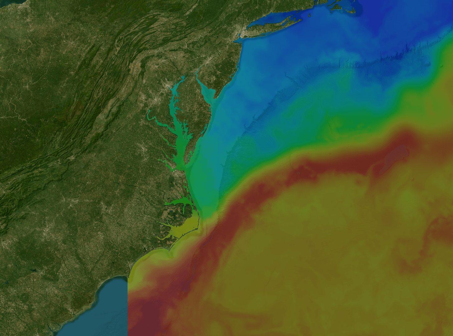
SST チャート
マグロやシイラがついている水温の境目を見つける。1km MUR 衛星画像、1 日・3 日・7 日合成 — 暖水が今どこにあり、どう動いているかが見える。
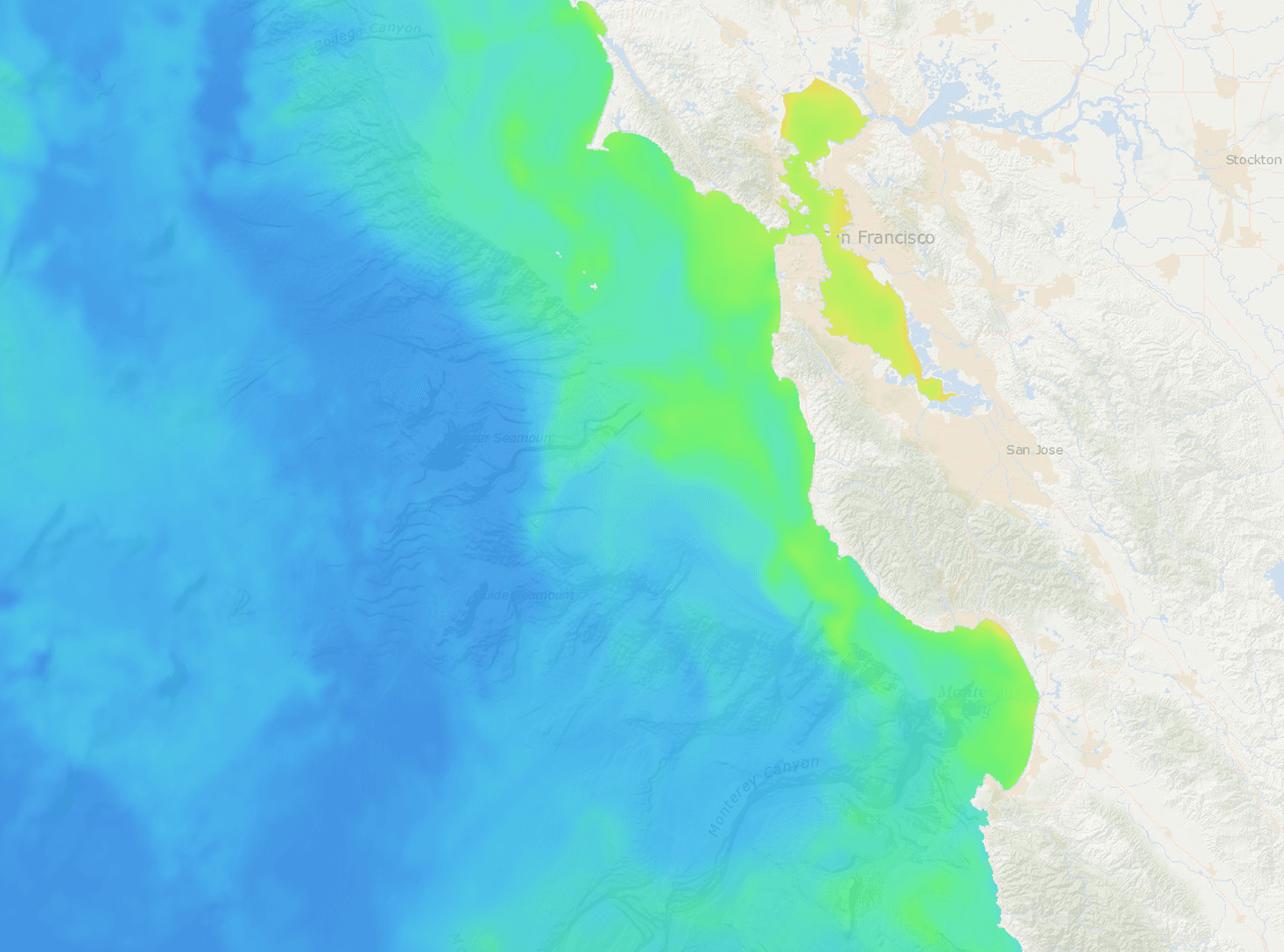
クロロフィル
ベイトが滞留する青緑の色境界を発見。VIIRS による対数スケールのクロロフィル-a 画像 — ベイトと生産帯がはっきり浮かび上がる。
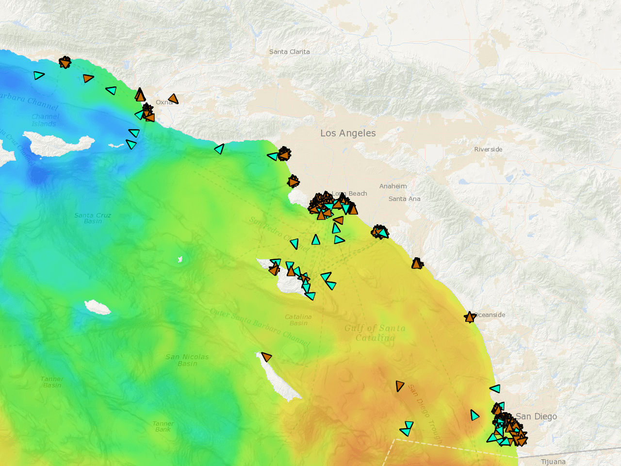
リアルタイム船団 AIS
今まさに動いている船団の位置を正確に把握。リアルタイム位置、速度別カラー航跡、72 時間再生。釣れていれば、すぐにわかる。
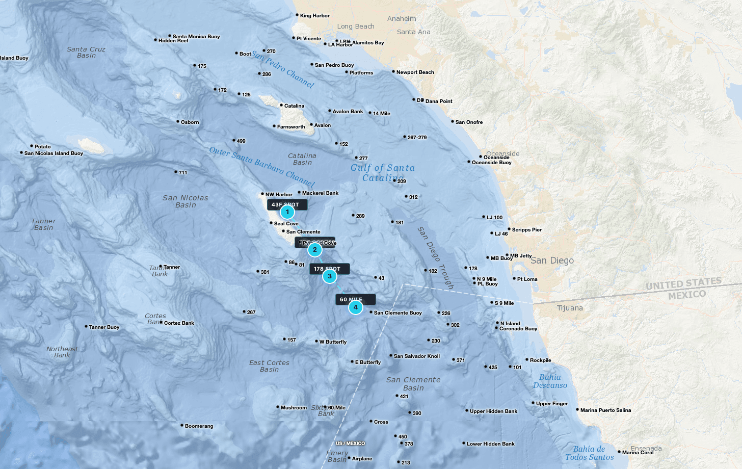
GPS ウェイポイント
Tanner、Cortez、295、Upper 500 — すべて事前ロード済み。マーカーを落とし、海里でルートを計画し、クルーとスポットを共有。

生衛星データ
雲のギャップが見える、フィルタなしの衛星パス。センサーが捉えた本当の海をそのまま見られる — 補間で隠された海ではない。
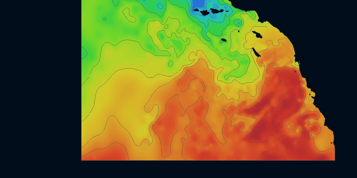
コンターライン
他のどこも描かない水温コンターライン。SST グラデーションに重ねた境界線 — 一目で境目を把握し、ベイトと捕食者が集まる場所を見つける。
Satellite Data,
Rendered Live
Toggle between sea surface temperature, chlorophyll, and live vessel tracking. Continuously refreshed throughout the day so you're always working from the latest available imagery.
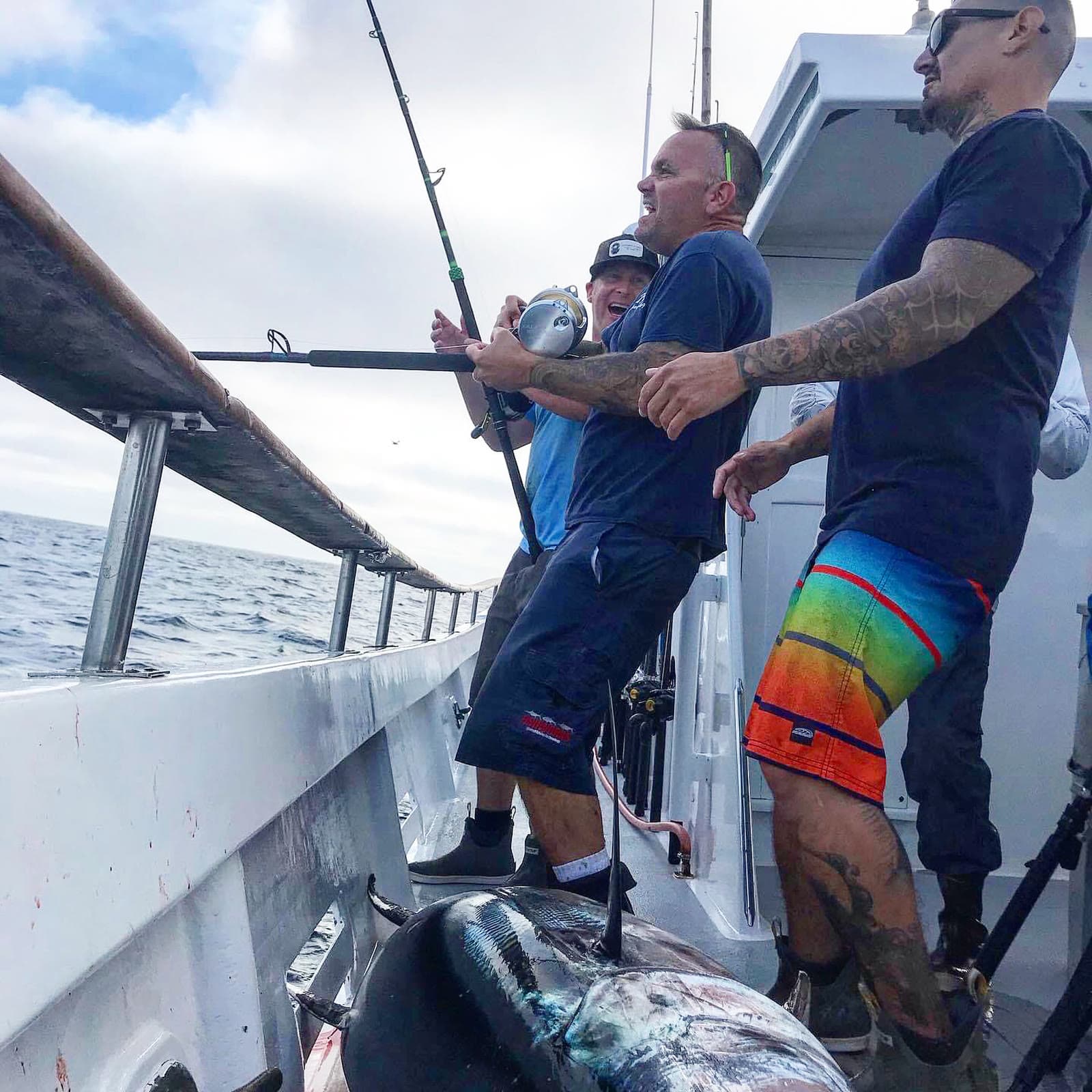
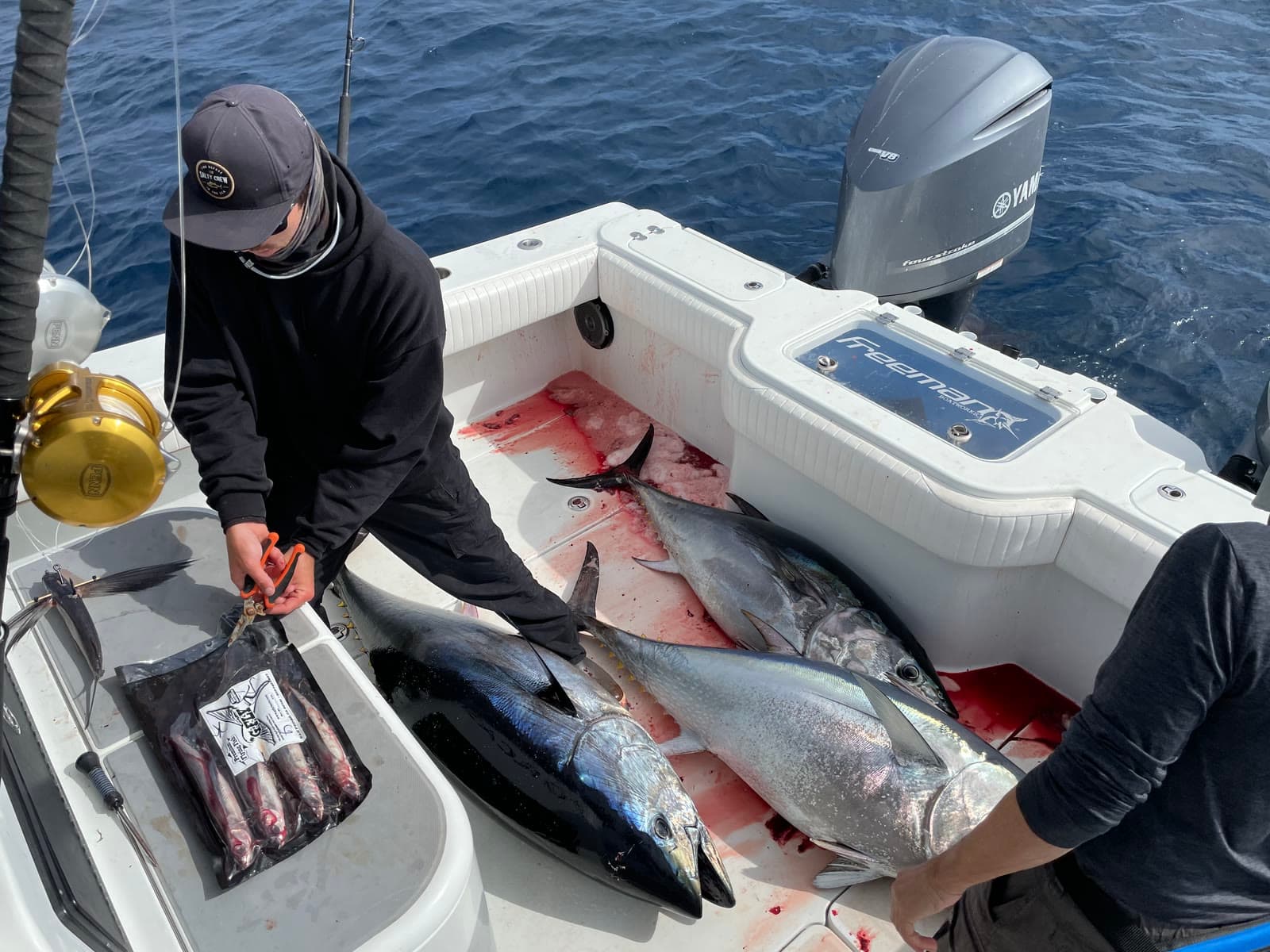
Charts in the morning. Catches by sundown.
Fresh ocean charts on your phone every three hours, around the clock. We do the heavy lifting so you can leave the dock with a plan.
SoCal Fishing Intelligence
Spotter-plane tracking and the verified-catch map ship only in the SoCal version, layered over the same temp breaks, chlorophyll edges and live fleet AIS. In the Santa Catalina Channel it put members on fish a full day before the sportboat fleet reached the same water.
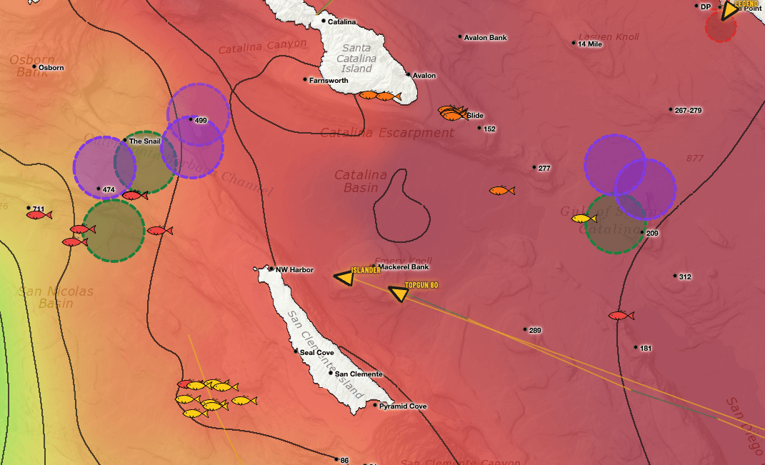
Two layers you won’t find anywhere else.
Satellite water is table stakes. These two come from people — pilots in the air and anglers on the water — and they only ship in the SoCal app.
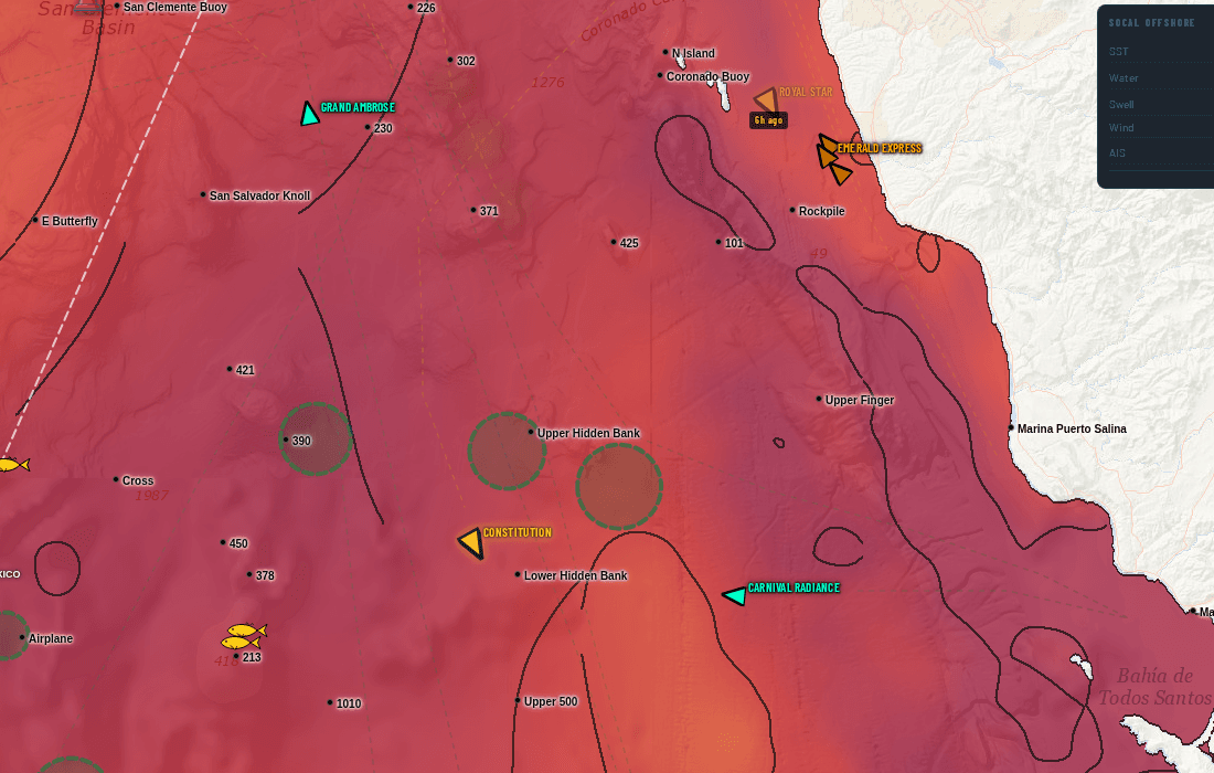
Somebody flew out and circled this water
Fish-spotting planes work the Bight every day. When one stops and orbits a patch of ocean, the pilot is looking at something — bait, breezing fish, a paddy. We track that flight activity and draw the zones they circled straight onto your chart.
On the live chart, swordfish spotters draw in purple and every other spotter draws in green, each on its own toggle — so you can tell a broadbill orbit from a tuna orbit at a glance.
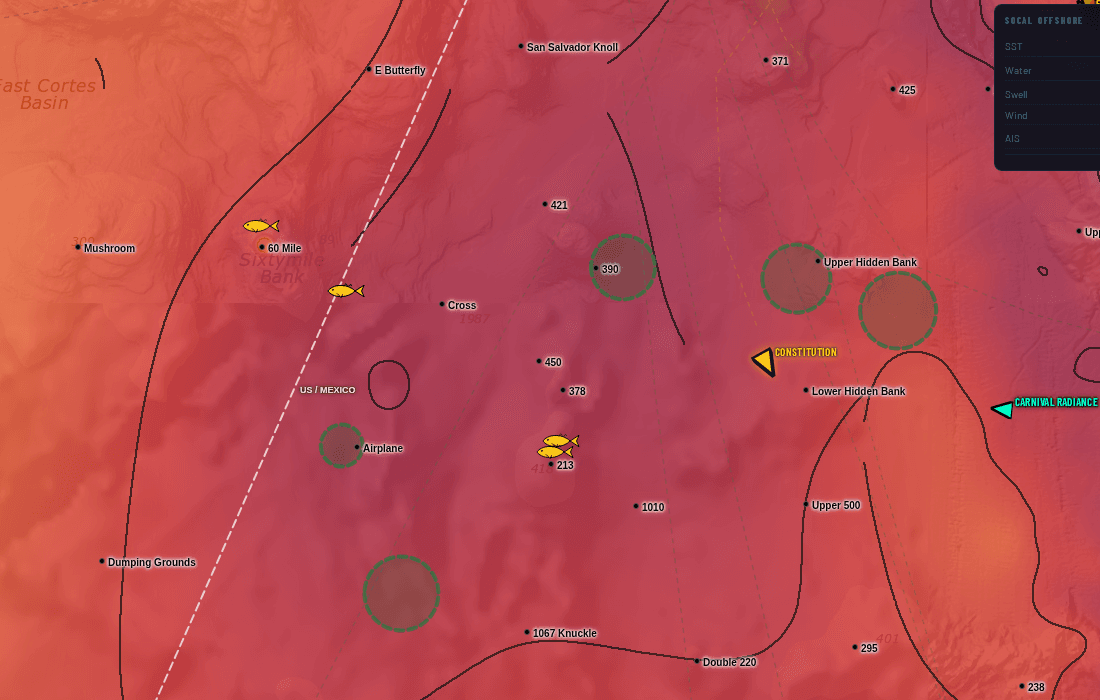
Real catches, pinned where they actually happened
Every fish icon is a verified catch plotted at its real position — not a rumour, not a screenshot of somebody's dock talk. Colour shows how fresh it is, and tapping a pin gives you species and timing.
Lay it over the temperature break and the fleet's stop circles and the pattern shows itself: the catches stack on the edges, and you can see the bite move day to day.
Spotter-plane AOIs and the confirmed-catch map are part of the Southern California subscription. They are not included in the US or International versions. See the full SoCal guide.
Stop stacking subscriptions.
Live vessel traffic. Custom watch list. 7-day playback. Buoy temps. Contour breaks. No other chart service in our comparison has all five — here they come bundled for one price.
Live vessel traffic + 72h playback
Watch your competition right now. See where they were drifting yesterday. Spot the bite before it ends.
Custom 50-vessel tracker
Your watch list. The boats you actually care about, not 5,000 commercial ships filling the screen.
Contour break overlays
Temperature breaks as crisp discrete lines. Find the edge faster, not gradient guesswork.
7-day chart playback
Scrub backwards. See where the temp break has been moving and where the green water shifted.
Live NDBC buoy temps
Real ocean temps from real buoys. Not satellite estimates filtered through cloud cover.
US + Intl coverage
PNW → NE for US. Mexico, Central America, Caribbean. One subscription, every coast you fish.
Satellite SST and chlorophyll, and on most a look back at earlier images. No live vessel traffic, so you guess where the boats are, you guess where the break moved, you spend the morning pinpointing what already happened.
Live AIS shows where your competition is right now. Your custom ring tells you the moment your watch boats stop. 7-day playback shows where the temp break has been moving. Buoy temps confirm satellite. You leave the dock knowing where to go.
あなたの海を選ぶ
4 つのプラン、月額課金、すべてに 7 日間無料トライアル。いつでもキャンセル可能。
米国
米国の全沿岸地域——太平洋岸北西部からニューイングランドまで、ハワイを含む。
7 日間無料トライアル · いつでもキャンセル可能
- 8 US regions (PNW, NorCal, SoCal, Hawaii, Gulf, SE, Mid-Atl, NE)
- SST + Chlorophyll (1d / 3d / 7d / raw)
- Live AIS vessel tracking
- 958 US coastal GPS waypoints
- Vessel watch list (up to 50)
- Contour overlays & basemaps
インターナショナル
米国 + メキシコ、中米、カリブ海。長距離船長のために設計。
7 日間無料トライアル · いつでもキャンセル可能
- Everything in US
- Mexico + Baja coverage
- Central America coverage
- Caribbean coverage
- International AIS tracking
- Priority support
SoCal
南カリフォルニア専用インテリジェンス——最高のデータ密度、船団ヒートマップ、リアルタイム漁場。
7 日間無料トライアル · いつでもキャンセル可能
- Dense SoCal SST + Chlorophyll
- Enhanced AIS vessel coverage
- 59-vessel watch list + playback
- Vessel-traffic fishing-stop heatmap (3-day)
- Spotter-plane areas of interest (SoCal only)
- Confirmed catch map — real catches, pinned (SoCal only)
- Active fishing zone detection
- Daily fishing reports
オールアクセス Pro パッケージ
すべての地域、すべての機能。SoCal インテリジェンス + 米国全域 + インターナショナル——1 つのサブスクリプション。
7 日間無料トライアル · いつでもキャンセル可能
- Everything in SoCal
- Everything in US (8 regions)
- Everything in International
- Single login across all apps
- One-click region switch
- Priority support