


더 많이 잡으세요. 그들이 머무는 경계선을 보세요.
온도 컨투어 라인을 그리는 유일한 낚시 앱. 한눈에 경계선이 보입니다. 실시간 선단 AIS, 7일 재생, 경쟁사보다 훨씬 저렴한 가격 — $9.99/월부터.
CATALYSST is real-time fishing intelligence — a blend of catalyst and SST (sea surface temperature).
Yes — spelled with a double S, on purpose. Not the word “catalyst.” Catalysst overlays live AIS vessel traffic with satellite sea surface temperature and chlorophyll charts, so you leave the dock knowing where the fish are — not where they were.
Real-time vessel traffic. Real catch data. Where the fish actually are.
Other apps show you yesterday's satellite gradient. We show you the temperature break, the vessel traffic on it, and 7 days of how it moved — so you leave the dock knowing where to go.
다른 어떤 앱도 결합하지 못한 5가지 도구.
모든 기능은 더 빨리 물고기에 닿게 하기 위해 존재합니다 — Hilton’s, FishDope, FishTrack 가격의 일부로.
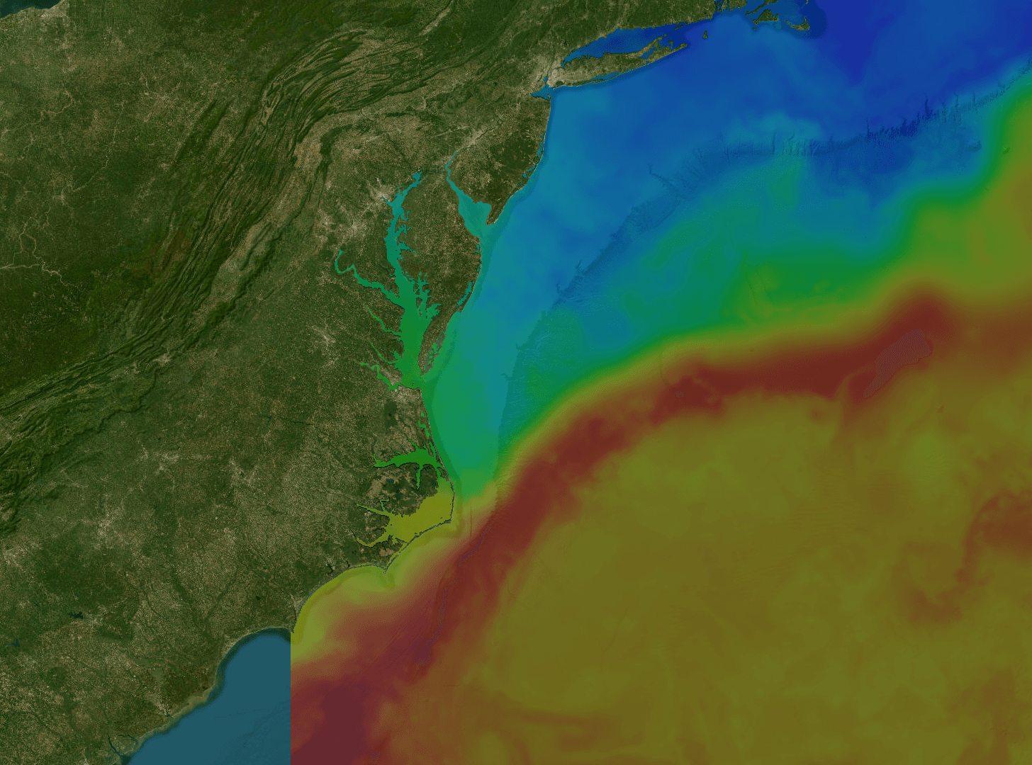
SST 차트
참치와 만새기가 모이는 온도 경계를 찾으세요. 1km MUR 위성, 1일·3일·7일 합성 — 따뜻한 물이 지금 어디 있고 어떻게 움직였는지 보입니다.
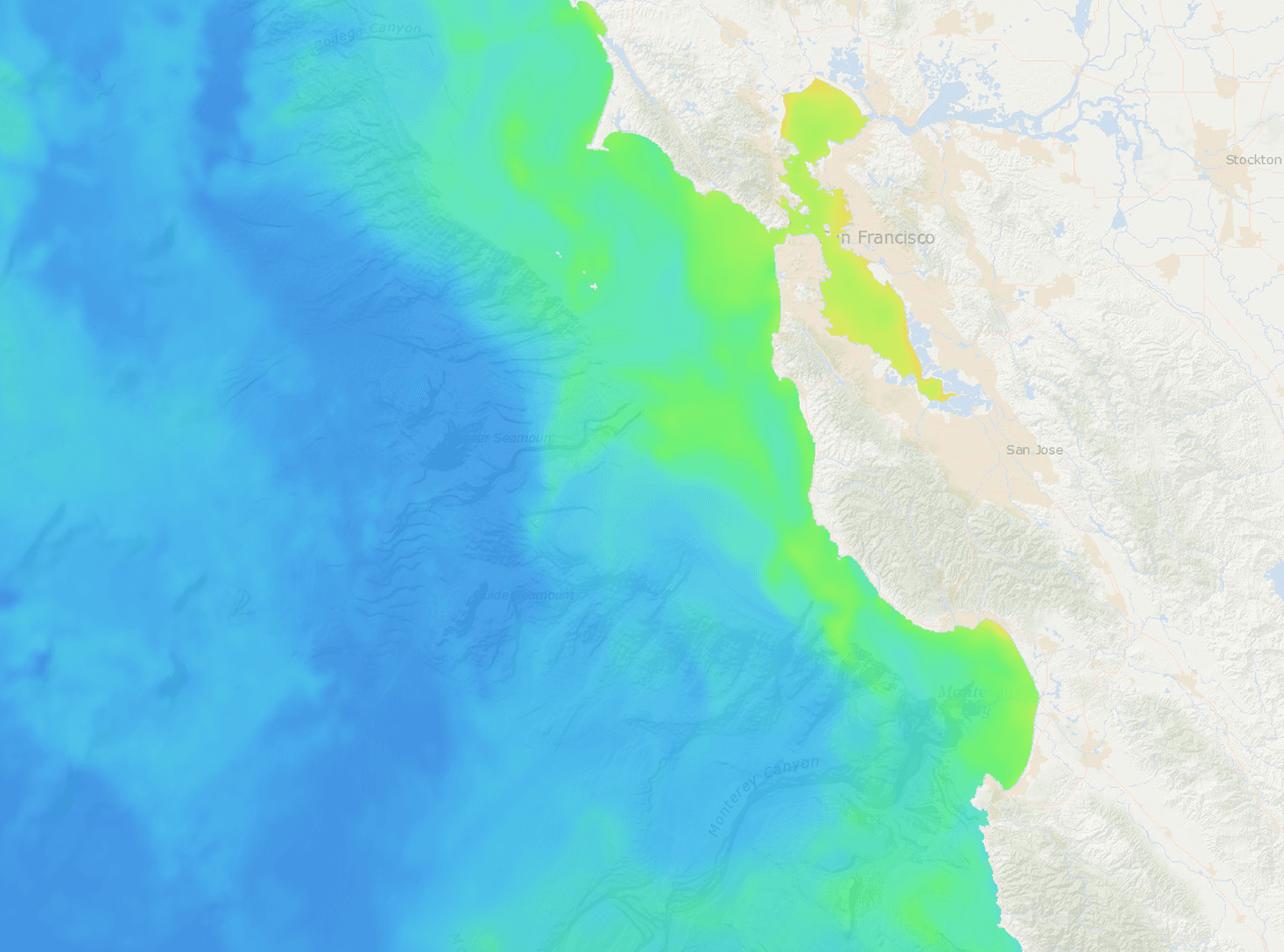
클로로필
미끼가 머무는 청록색 경계를 발견하세요. VIIRS 로그 스케일 클로로필-a — 미끼와 생산성 구역이 한눈에 들어옵니다.
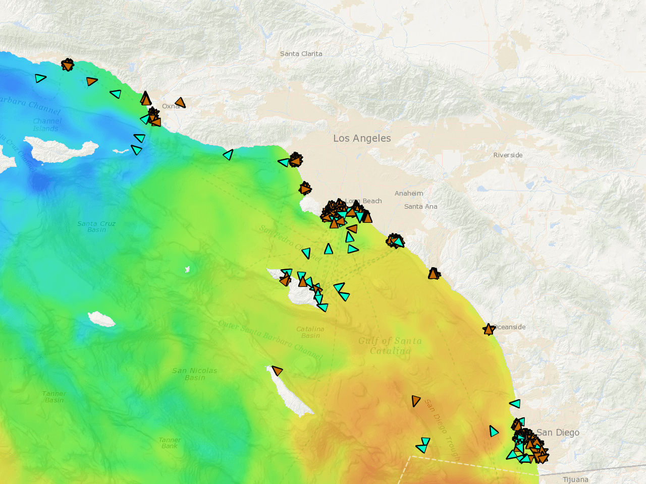
실시간 선단 AIS
지금 일하는 선단의 정확한 위치. 실시간 좌표, 속도별 색상 트레일, 72시간 재생. 그들이 잡고 있다면, 어디인지 알 수 있습니다.
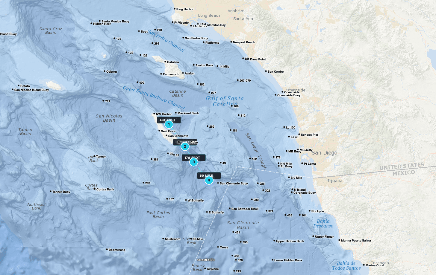
GPS 웨이포인트
Tanner, Cortez, 295, Upper 500 — 모두 사전 로드. 직접 표시하고, 해리 단위로 경로를 계획하고, 크루와 스팟을 공유하세요.
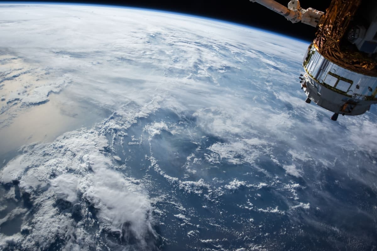
원본 위성
구름 갭이 보이는 필터링되지 않은 위성 패스. 센서가 본 그대로의 진짜 바다 — 보간으로 가려진 바다가 아닙니다.
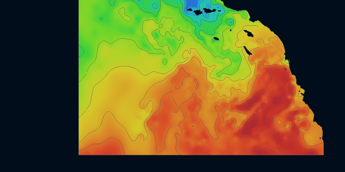
컨투어 라인
아무도 그리지 않는 온도 컨투어 라인. SST 그래디언트 위에 겹친 분리선 — 한눈에 경계를 보고, 미끼와 포식자가 쌓이는 곳을 찾으세요.
Satellite Data,
Rendered Live
Toggle between sea surface temperature, chlorophyll, and live vessel tracking. Continuously refreshed throughout the day so you're always working from the latest available imagery.
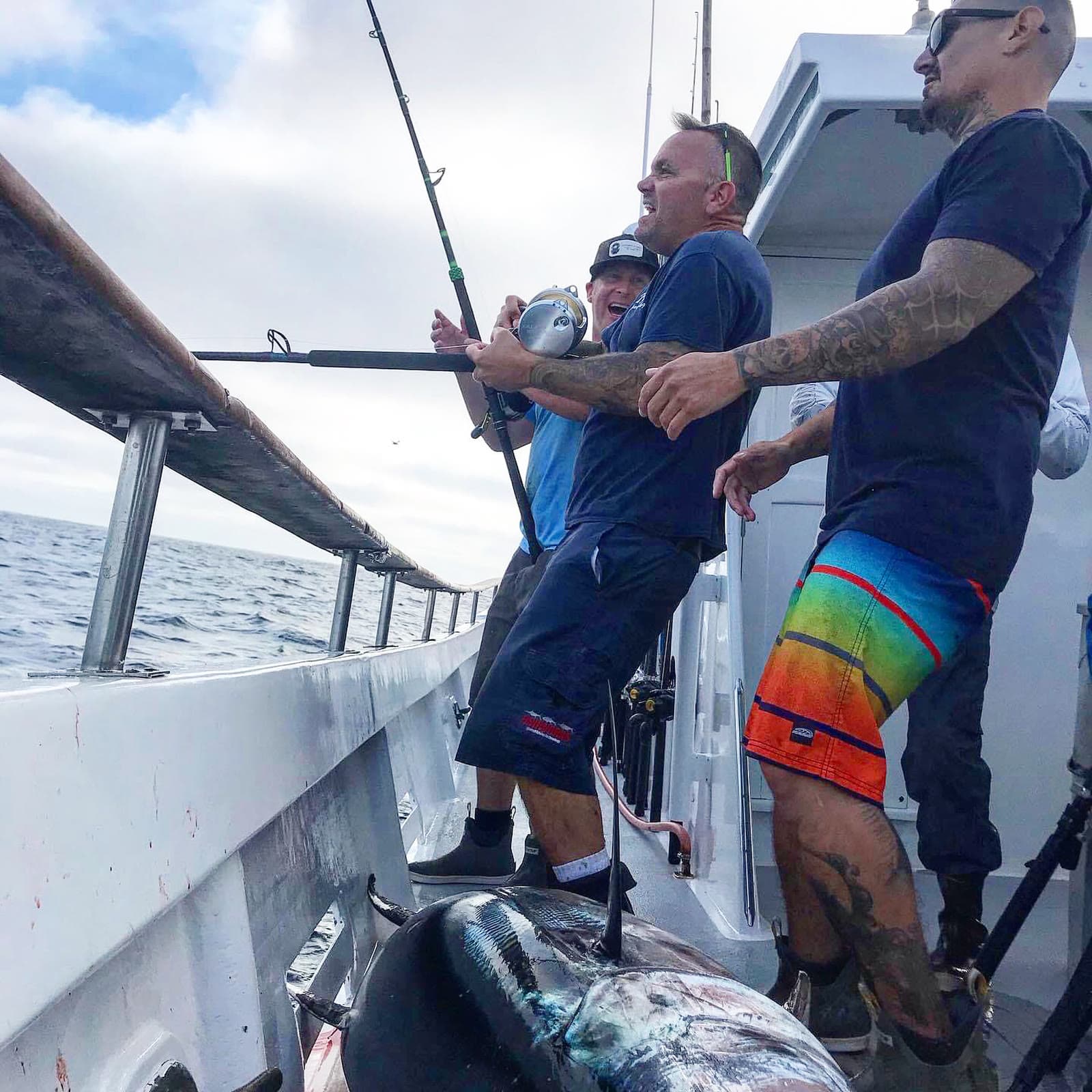
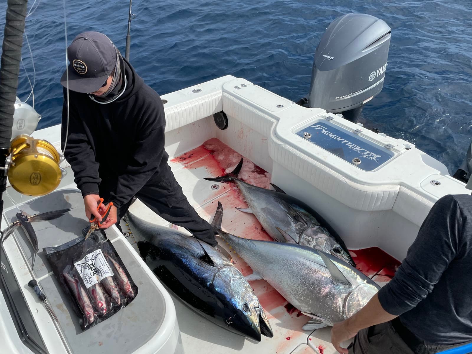
Charts in the morning. Catches by sundown.
Fresh ocean charts on your phone every three hours, around the clock. We do the heavy lifting so you can leave the dock with a plan.
SoCal Fishing Intelligence
Spotter-plane tracking and the verified-catch map ship only in the SoCal version, layered over the same temp breaks, chlorophyll edges and live fleet AIS. In the Santa Catalina Channel it put members on fish a full day before the sportboat fleet reached the same water.
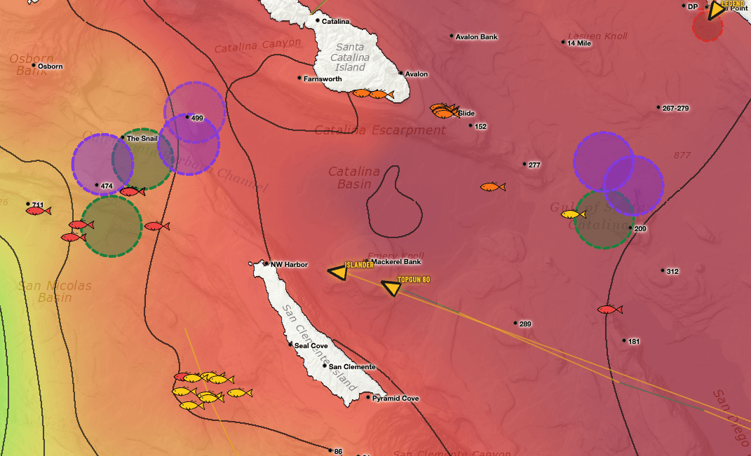
Two layers you won’t find anywhere else.
Satellite water is table stakes. These two come from people — pilots in the air and anglers on the water — and they only ship in the SoCal app.
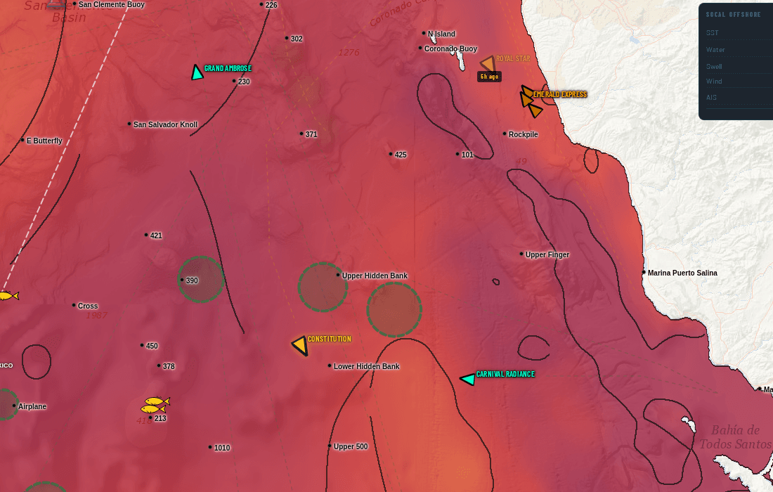
Somebody flew out and circled this water
Fish-spotting planes work the Bight every day. When one stops and orbits a patch of ocean, the pilot is looking at something — bait, breezing fish, a paddy. We track that flight activity and draw the zones they circled straight onto your chart.
On the live chart, swordfish spotters draw in purple and every other spotter draws in green, each on its own toggle — so you can tell a broadbill orbit from a tuna orbit at a glance.
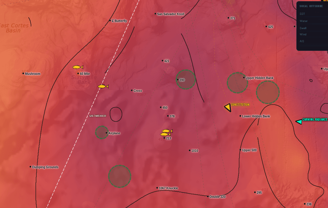
Real catches, pinned where they actually happened
Every fish icon is a verified catch plotted at its real position — not a rumour, not a screenshot of somebody's dock talk. Colour shows how fresh it is, and tapping a pin gives you species and timing.
Lay it over the temperature break and the fleet's stop circles and the pattern shows itself: the catches stack on the edges, and you can see the bite move day to day.
Spotter-plane AOIs and the confirmed-catch map are part of the Southern California subscription. They are not included in the US or International versions. See the full SoCal guide.
Stop stacking subscriptions.
Live vessel traffic. Custom watch list. 7-day playback. Buoy temps. Contour breaks. No other chart service in our comparison has all five — here they come bundled for one price.
Live vessel traffic + 72h playback
Watch your competition right now. See where they were drifting yesterday. Spot the bite before it ends.
Custom 50-vessel tracker
Your watch list. The boats you actually care about, not 5,000 commercial ships filling the screen.
Contour break overlays
Temperature breaks as crisp discrete lines. Find the edge faster, not gradient guesswork.
7-day chart playback
Scrub backwards. See where the temp break has been moving and where the green water shifted.
Live NDBC buoy temps
Real ocean temps from real buoys. Not satellite estimates filtered through cloud cover.
US + Intl coverage
PNW → NE for US. Mexico, Central America, Caribbean. One subscription, every coast you fish.
Satellite SST and chlorophyll, and on most a look back at earlier images. No live vessel traffic, so you guess where the boats are, you guess where the break moved, you spend the morning pinpointing what already happened.
Live AIS shows where your competition is right now. Your custom ring tells you the moment your watch boats stop. 7-day playback shows where the temp break has been moving. Buoy temps confirm satellite. You leave the dock knowing where to go.
당신의 바다를 선택하세요
네 가지 요금제, 월간 청구, 모든 요금제에 7일 무료 체험. 언제든 취소 가능.
미국
모든 미국 해안 지역 — 태평양 북서부에서 뉴잉글랜드까지, 하와이 포함.
7일 무료 체험 · 언제든 취소
- 8 US regions (PNW, NorCal, SoCal, Hawaii, Gulf, SE, Mid-Atl, NE)
- SST + Chlorophyll (1d / 3d / 7d / raw)
- Live AIS vessel tracking
- 958 US coastal GPS waypoints
- Vessel watch list (up to 50)
- Contour overlays & basemaps
국제
미국 + 멕시코, 중앙아메리카, 카리브해. 장거리 선장을 위해 설계.
7일 무료 체험 · 언제든 취소
- Everything in US
- Mexico + Baja coverage
- Central America coverage
- Caribbean coverage
- International AIS tracking
- Priority support
SoCal
남부 캘리포니아 특화 인텔리전스 — 최고 데이터 밀도, 선단 히트맵, 실시간 조업 구역.
7일 무료 체험 · 언제든 취소
- Dense SoCal SST + Chlorophyll
- Enhanced AIS vessel coverage
- 59-vessel watch list + playback
- Vessel-traffic fishing-stop heatmap (3-day)
- Spotter-plane areas of interest (SoCal only)
- Confirmed catch map — real catches, pinned (SoCal only)
- Active fishing zone detection
- Daily fishing reports
올 액세스 프로 패키지
모든 지역, 모든 기능. SoCal 인텔리전스 + 미국 전체 + 국제 — 하나의 구독으로.
7일 무료 체험 · 언제든 취소
- Everything in SoCal
- Everything in US (8 regions)
- Everything in International
- Single login across all apps
- One-click region switch
- Priority support