


Pesca más. Ve los breaks donde están.
La única app que dibuja líneas de contorno de temperatura, para que veas los breaks de un vistazo. AIS de flota en vivo, reproducción de 7 días, y precios que vencen a la competencia — desde $9.99/mes.
CATALYSST is real-time fishing intelligence — a blend of catalyst and SST (sea surface temperature).
Yes — spelled with a double S, on purpose. Not the word “catalyst.” Catalysst overlays live AIS vessel traffic with satellite sea surface temperature and chlorophyll charts, so you leave the dock knowing where the fish are — not where they were.
Real-time vessel traffic. Real catch data. Where the fish actually are.
Other apps show you yesterday's satellite gradient. We show you the temperature break, the vessel traffic on it, and 7 days of how it moved — so you leave the dock knowing where to go.
Cinco herramientas que ninguna otra app combina.
Cada función está aquí para ponerte sobre los peces antes — a una fracción de lo que cobran Hilton’s, FishDope o FishTrack.
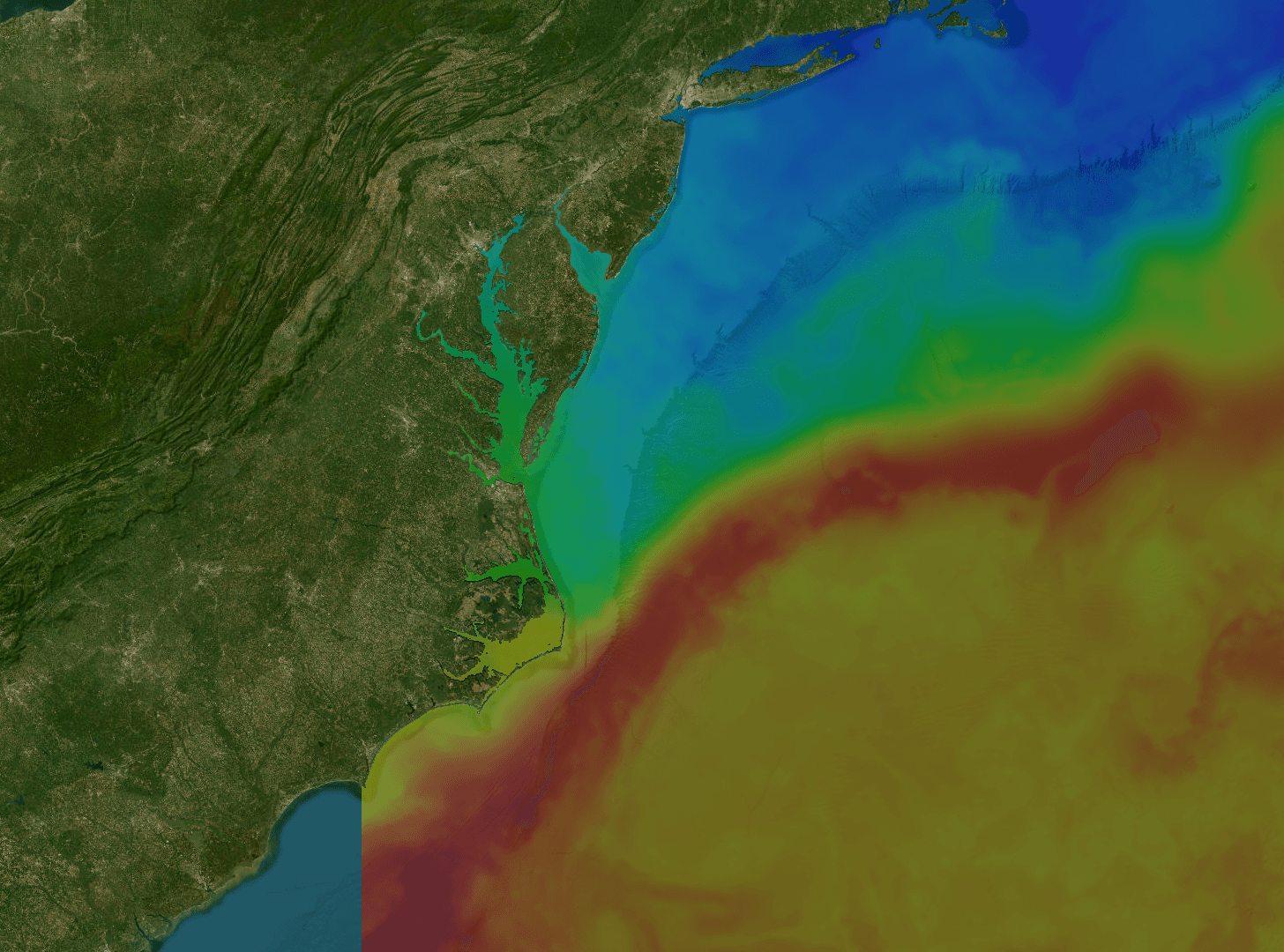
Cartas SST
Encuentra los breaks de temperatura donde se concentran atunes y dorados. Imagen MUR de 1 km, composiciones 1, 3 y 7 días — mira dónde está el agua caliente ahora y cómo se ha movido.
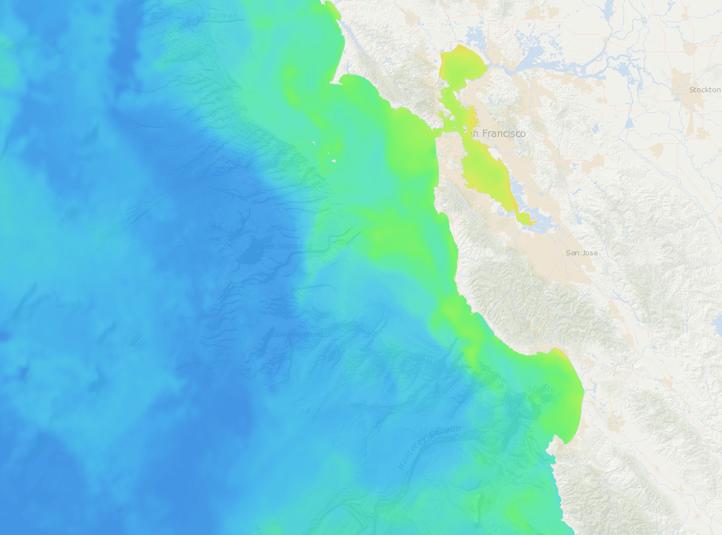
Clorofila
Detecta los bordes verde-azul donde se queda la carnada. Imágenes de clorofila-a en escala log de VIIRS — concentraciones y zonas productivas saltan a la vista.
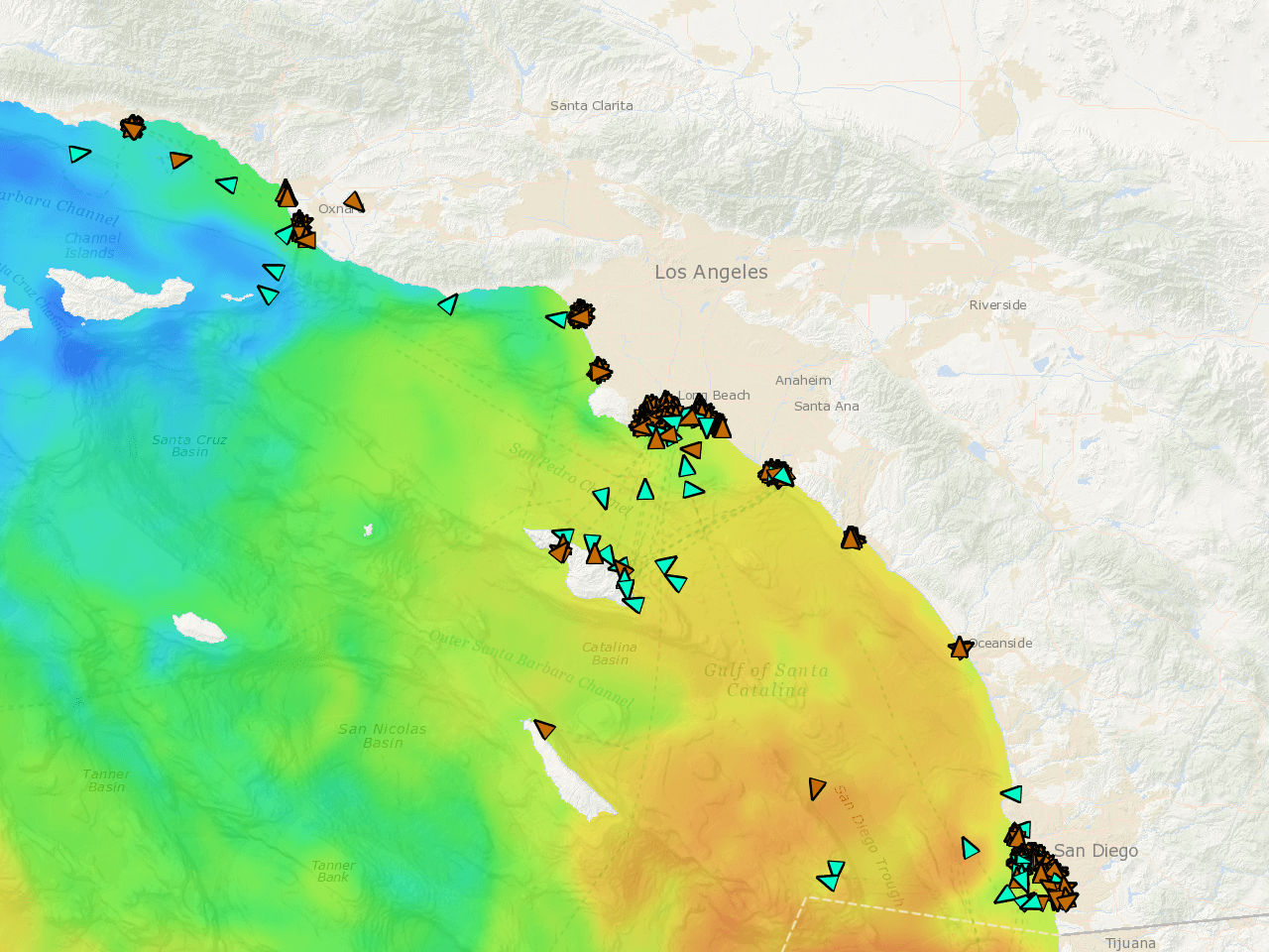
Flota AIS en vivo
Mira exactamente dónde está la flota trabajando ahora. Posiciones en tiempo real, estelas por velocidad, reproducción de 72 h. Si están pescando, lo sabrás.
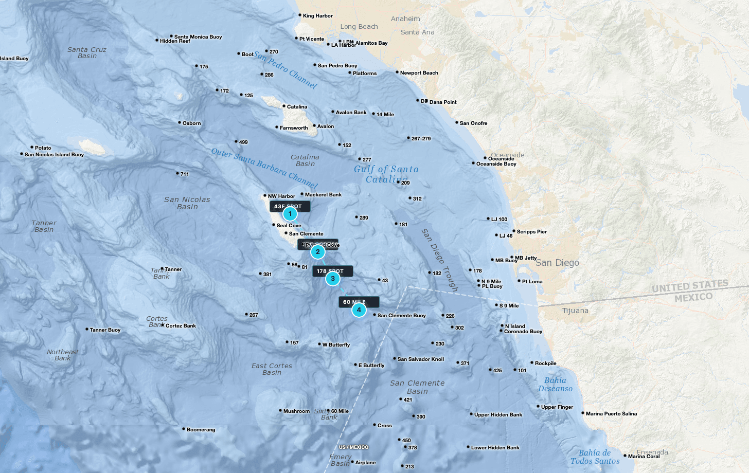
Puntos GPS
Tanner, Cortez, el 295, el Upper 500 — todos precargados. Marca tus puntos, planifica rutas en millas náuticas, comparte spots con tu tripulación.

Satélite sin procesar
Pases satelitales sin filtrar con huecos de nubes visibles. Mira exactamente lo que captó el sensor — sin interpolación que te oculte el océano real.
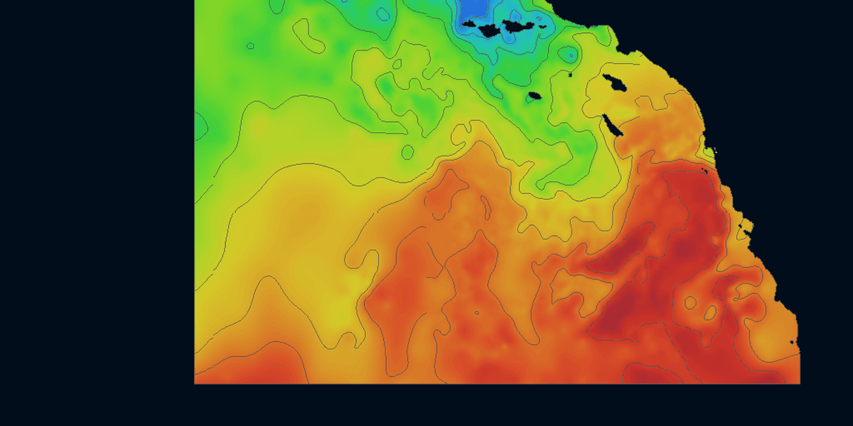
Líneas de contorno
Líneas de contorno de temperatura que nadie más dibuja. Bordes discretos sobre el gradiente SST — ve los breaks de un vistazo, encuentra dónde se acumulan carnada y depredadores.
Satellite Data,
Rendered Live
Toggle between sea surface temperature, chlorophyll, and live vessel tracking. Continuously refreshed throughout the day so you're always working from the latest available imagery.
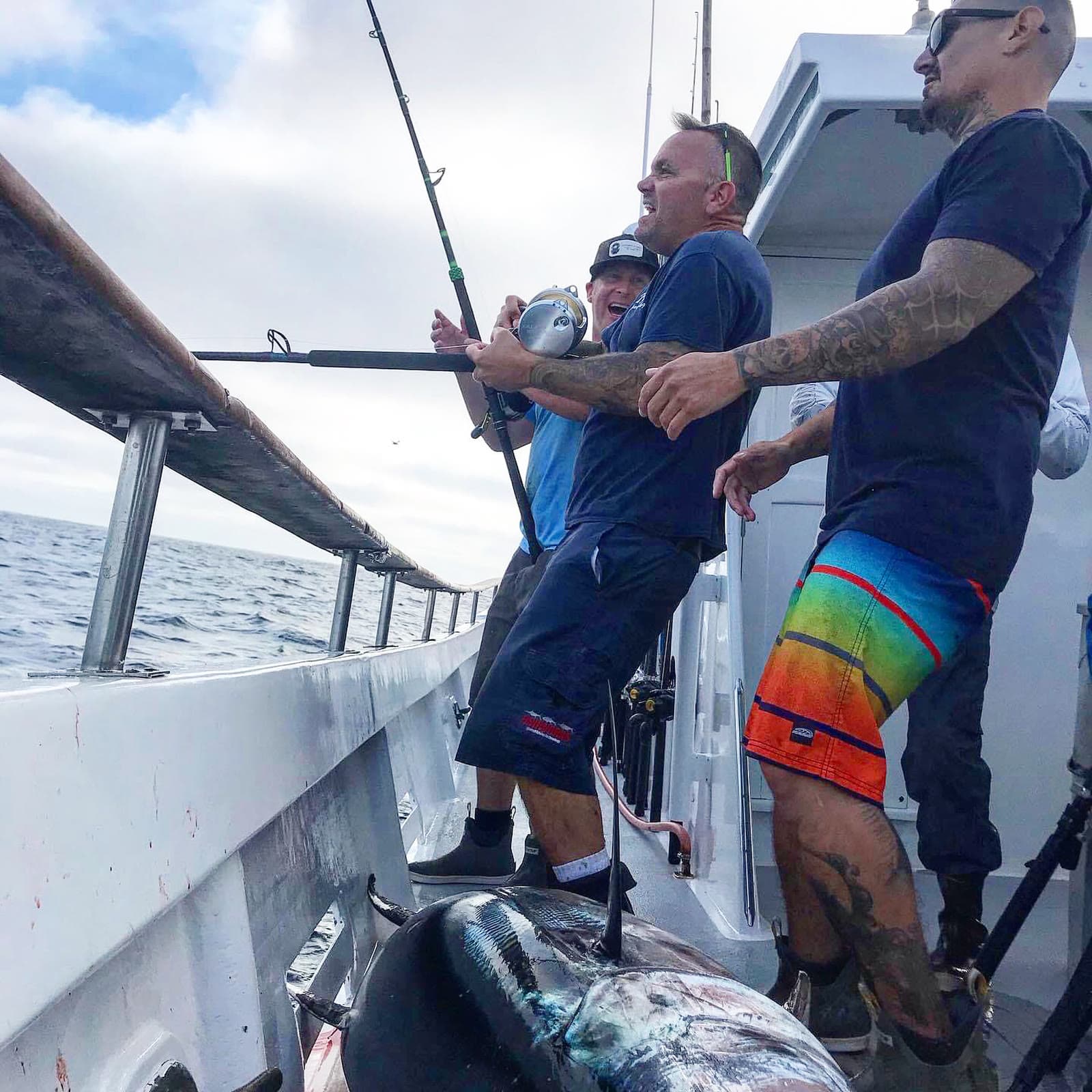
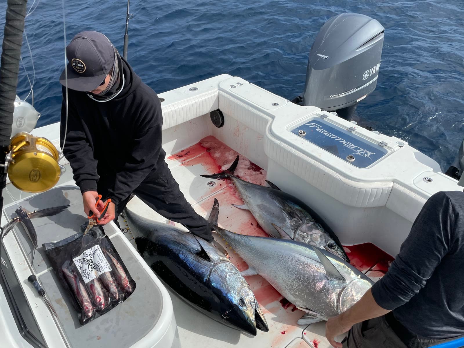
Charts in the morning. Catches by sundown.
Fresh ocean charts on your phone every three hours, around the clock. We do the heavy lifting so you can leave the dock with a plan.
SoCal Fishing Intelligence
Spotter-plane tracking and the verified-catch map ship only in the SoCal version, layered over the same temp breaks, chlorophyll edges and live fleet AIS. In the Santa Catalina Channel it put members on fish a full day before the sportboat fleet reached the same water.
Two layers you won’t find anywhere else.
Satellite water is table stakes. These two come from people — pilots in the air and anglers on the water — and they only ship in the SoCal app.
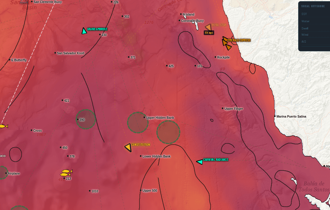
Somebody flew out and circled this water
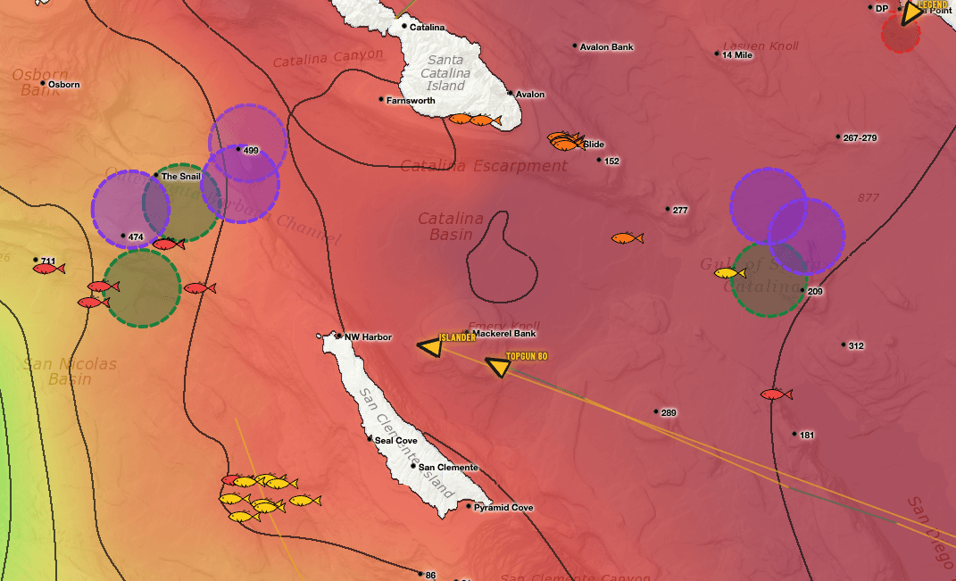
Fish-spotting planes work the Bight every day. When one stops and orbits a patch of ocean, the pilot is looking at something — bait, breezing fish, a paddy. We track that flight activity and draw the zones they circled straight onto your chart.
On the live chart, swordfish spotters draw in purple and every other spotter draws in green, each on its own toggle — so you can tell a broadbill orbit from a tuna orbit at a glance.
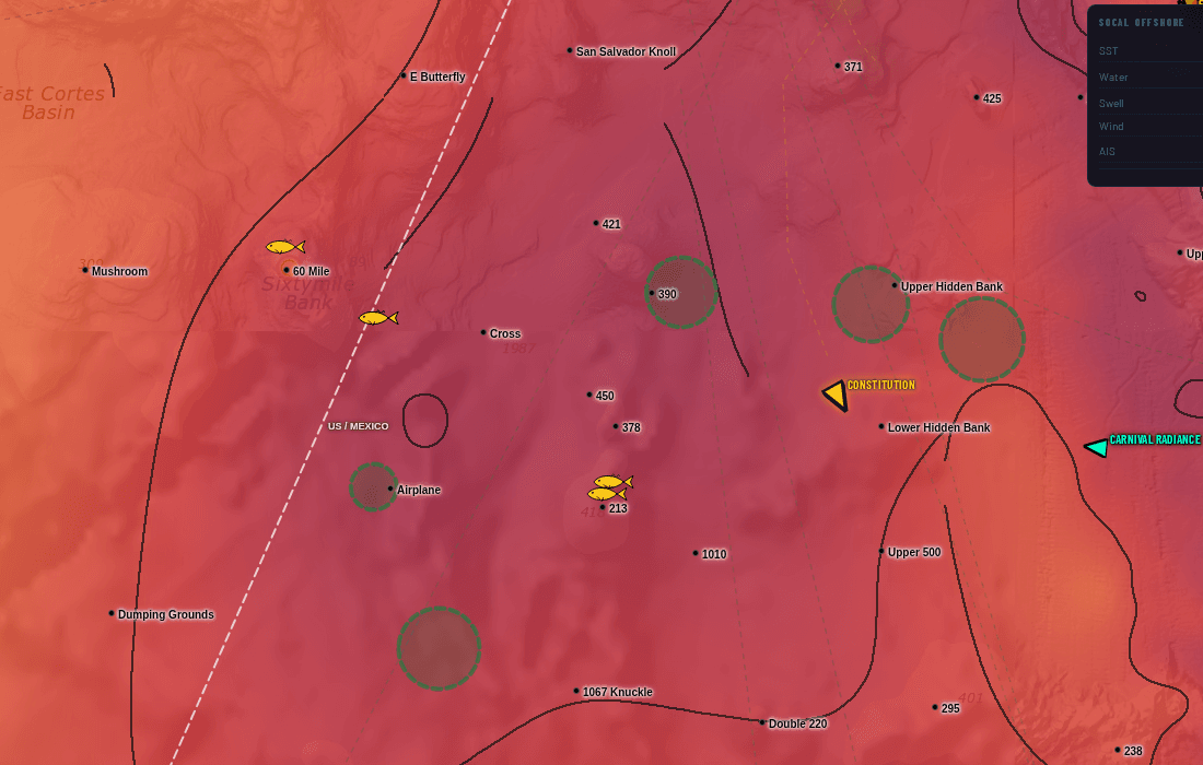
Real catches, pinned where they actually happened
Every fish icon is a verified catch plotted at its real position — not a rumour, not a screenshot of somebody's dock talk. Colour shows how fresh it is, and tapping a pin gives you species and timing.
Lay it over the temperature break and the fleet's stop circles and the pattern shows itself: the catches stack on the edges, and you can see the bite move day to day.
Spotter-plane AOIs and the confirmed-catch map are part of the Southern California subscription. They are not included in the US or International versions. See the full SoCal guide.
Stop stacking subscriptions.
Live vessel traffic. Custom watch list. 7-day playback. Buoy temps. Contour breaks. No other chart service in our comparison has all five — here they come bundled for one price.
Live vessel traffic + 72h playback
Watch your competition right now. See where they were drifting yesterday. Spot the bite before it ends.
Custom 50-vessel tracker
Your watch list. The boats you actually care about, not 5,000 commercial ships filling the screen.
Contour break overlays
Temperature breaks as crisp discrete lines. Find the edge faster, not gradient guesswork.
7-day chart playback
Scrub backwards. See where the temp break has been moving and where the green water shifted.
Live NDBC buoy temps
Real ocean temps from real buoys. Not satellite estimates filtered through cloud cover.
US + Intl coverage
PNW → NE for US. Mexico, Central America, Caribbean. One subscription, every coast you fish.
Satellite SST and chlorophyll, and on most a look back at earlier images. No live vessel traffic, so you guess where the boats are, you guess where the break moved, you spend the morning pinpointing what already happened.
Live AIS shows where your competition is right now. Your custom ring tells you the moment your watch boats stop. 7-day playback shows where the temp break has been moving. Buoy temps confirm satellite. You leave the dock knowing where to go.
Elige tu agua
Cuatro planes, facturación mensual, prueba gratis de 7 días en cada uno. Cancela cuando quieras.
EE. UU.
Todas las regiones costeras de EE. UU. — del Pacífico Noroeste a Nueva Inglaterra, más Hawái.
Prueba gratuita de 7 días · cancela cuando quieras
- 8 US regions (PNW, NorCal, SoCal, Hawaii, Gulf, SE, Mid-Atl, NE)
- SST + Chlorophyll (1d / 3d / 7d / raw)
- Live AIS vessel tracking
- 958 US coastal GPS waypoints
- Vessel watch list (up to 50)
- Contour overlays & basemaps
Internacional
EE. UU. + México, Centroamérica y el Caribe. Diseñado para capitanes de larga distancia.
Prueba gratuita de 7 días · cancela cuando quieras
- Everything in US
- Mexico + Baja coverage
- Central America coverage
- Caribbean coverage
- International AIS tracking
- Priority support
SoCal
Inteligencia especializada del sur de California — máxima densidad de datos, mapa de calor de flota, zonas de pesca en tiempo real.
Prueba gratuita de 7 días · cancela cuando quieras
- Dense SoCal SST + Chlorophyll
- Enhanced AIS vessel coverage
- 59-vessel watch list + playback
- Vessel-traffic fishing-stop heatmap (3-day)
- Spotter-plane areas of interest (SoCal only)
- Confirmed catch map — real catches, pinned (SoCal only)
- Active fishing zone detection
- Daily fishing reports
Paquete Pro Acceso Total
Todas las regiones, todas las funciones. Inteligencia SoCal + EE. UU. completo + Internacional — una sola suscripción.
Prueba gratuita de 7 días · cancela cuando quieras
- Everything in SoCal
- Everything in US (8 regions)
- Everything in International
- Single login across all apps
- One-click region switch
- Priority support