


钓更多鱼。看清它们停留的水温边界。
唯一一款绘制温度等值线的钓鱼应用——一眼看清边界。实时船队 AIS、7 天回放、价格远低于所有竞争对手——每月仅 $9.99 起。
CATALYSST is real-time fishing intelligence — a blend of catalyst and SST (sea surface temperature).
Yes — spelled with a double S, on purpose. Not the word “catalyst.” Catalysst overlays live AIS vessel traffic with satellite sea surface temperature and chlorophyll charts, so you leave the dock knowing where the fish are — not where they were.
Real-time vessel traffic. Real catch data. Where the fish actually are.
Other apps show you yesterday's satellite gradient. We show you the temperature break, the vessel traffic on it, and 7 days of how it moved — so you leave the dock knowing where to go.
没有任何其他应用结合的 5 项工具。
每项功能都是为了让你更快地找到鱼——价格只是 Hilton’s、FishDope、FishTrack 的一小部分。
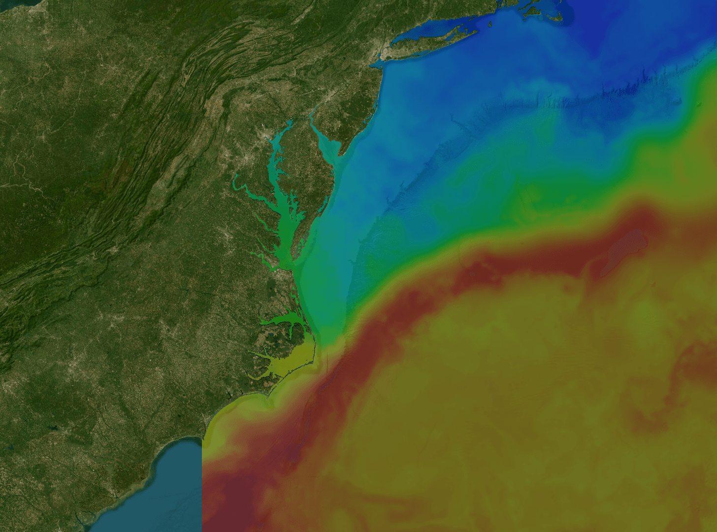
SST 图
找到金枪鱼和鬼头刀聚集的水温边界。1km MUR 卫星影像,1/3/7 天合成——看清暖水现在在哪里,以及如何移动。
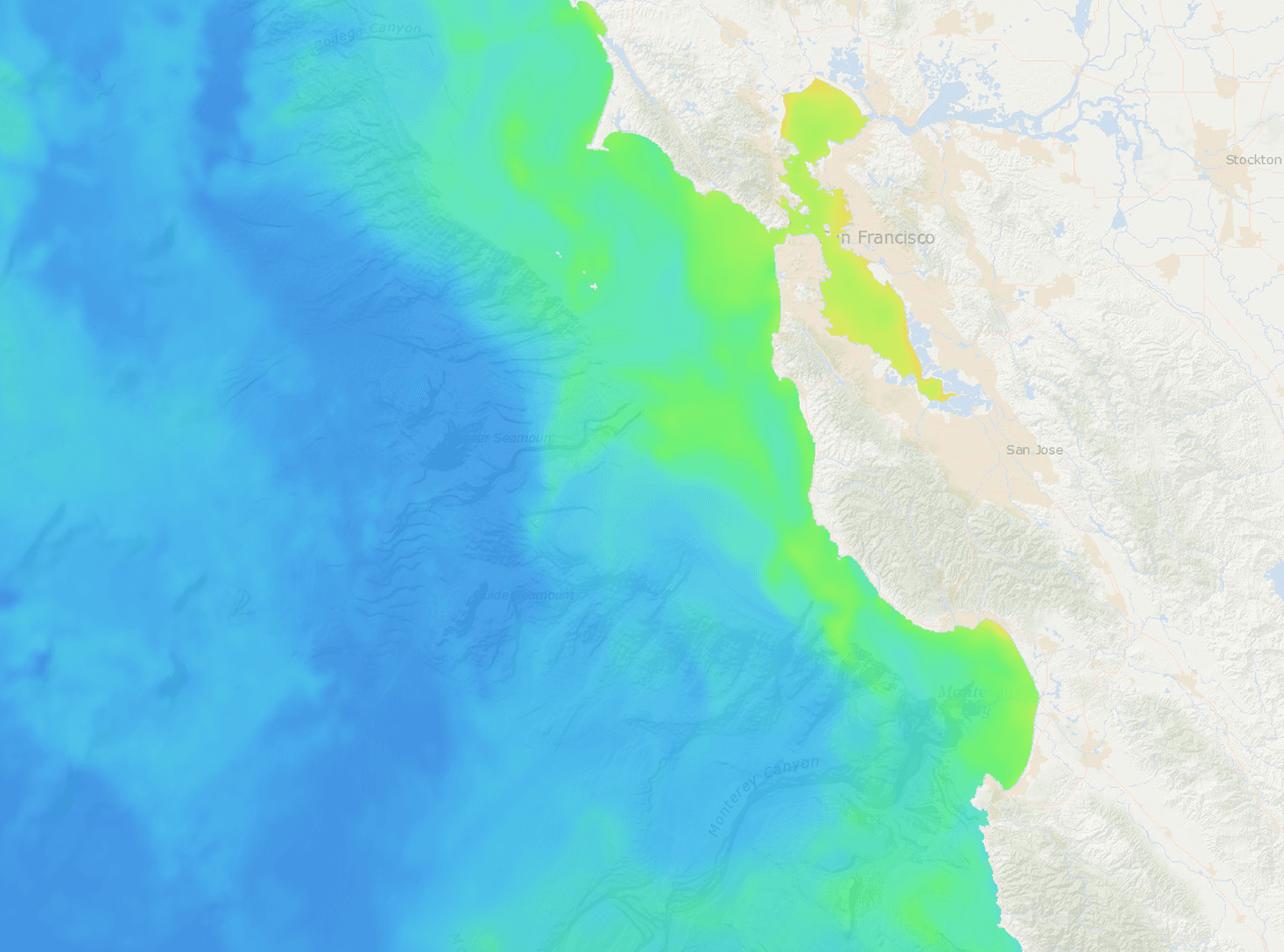
叶绿素
发现饵料聚集的蓝绿色边界。VIIRS 对数刻度叶绿素-a——饵料和生产区一目了然。
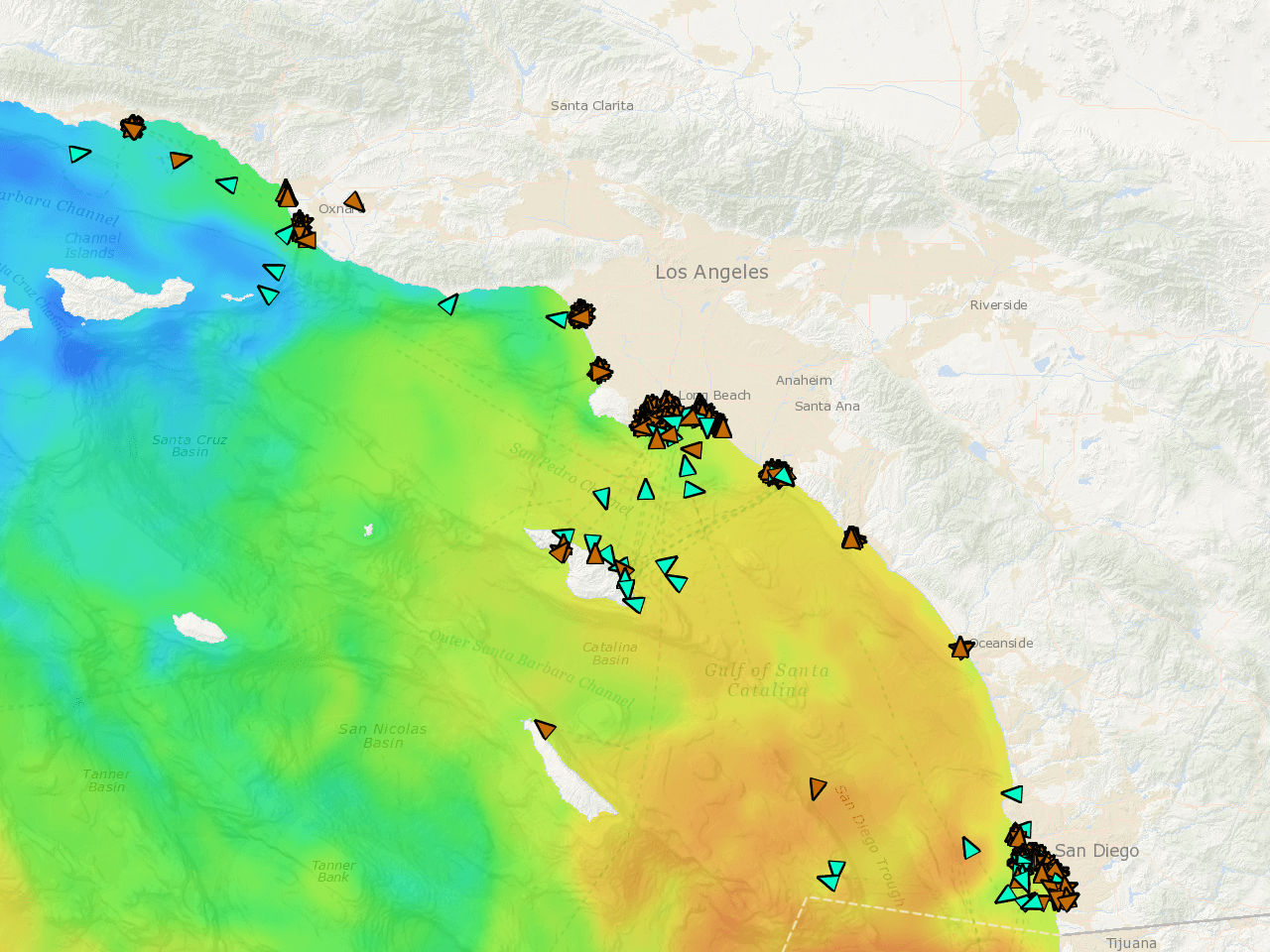
实时船队 AIS
准确知道作业船队此刻在哪里。实时位置、按速度着色的轨迹、72 小时回放。如果他们在钓,你会知道。
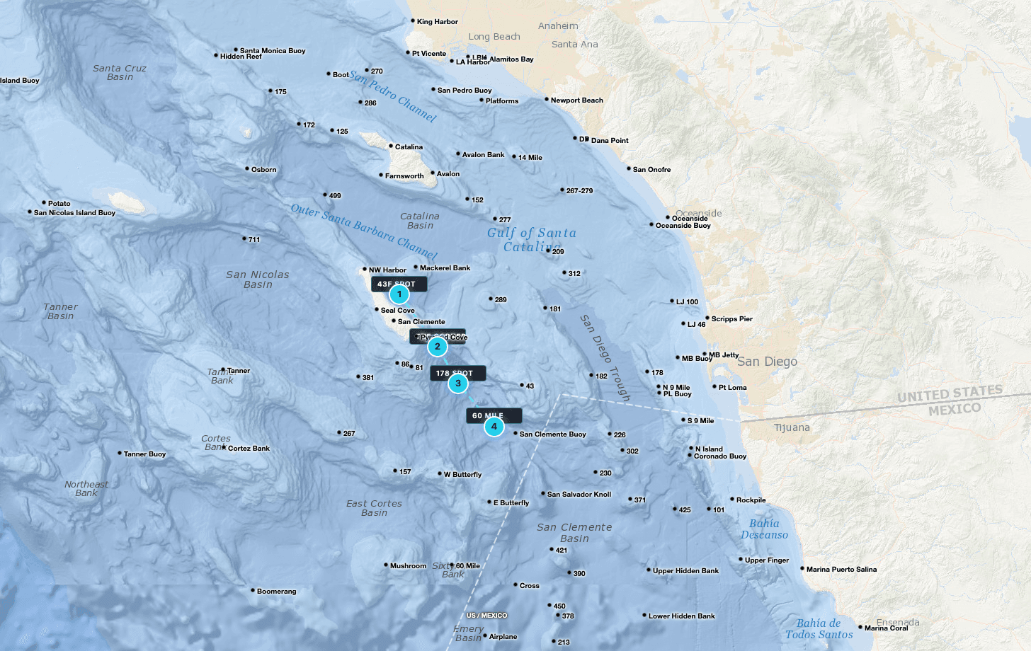
GPS 路标
Tanner、Cortez、295、Upper 500——全部预装。自定义标点,按海里规划航线,与船员共享钓点。

原始卫星
未过滤的卫星过境数据,可见云间隙。看到传感器真实捕捉到的海洋——不是被插值掩盖的海。
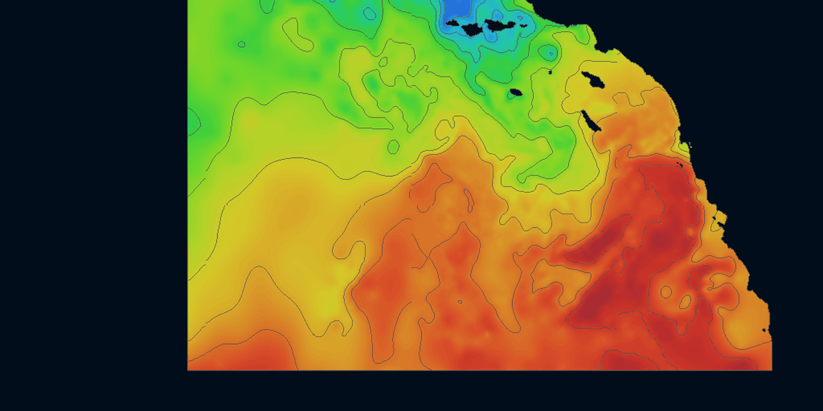
等值线
别人不画的温度等值线。叠加在 SST 渐变上的离散边界线——一眼看清边界,找到饵料和掠食者聚集的位置。
Satellite Data,
Rendered Live
Toggle between sea surface temperature, chlorophyll, and live vessel tracking. Continuously refreshed throughout the day so you're always working from the latest available imagery.
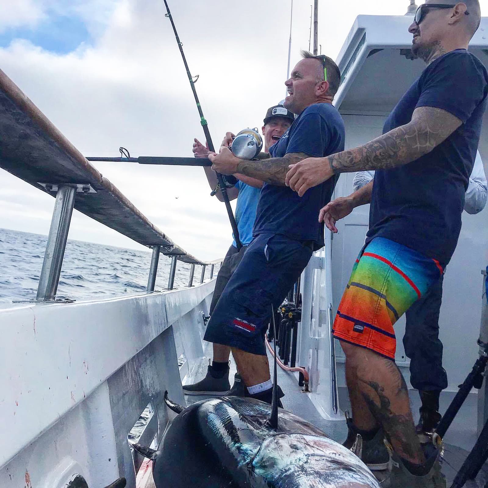
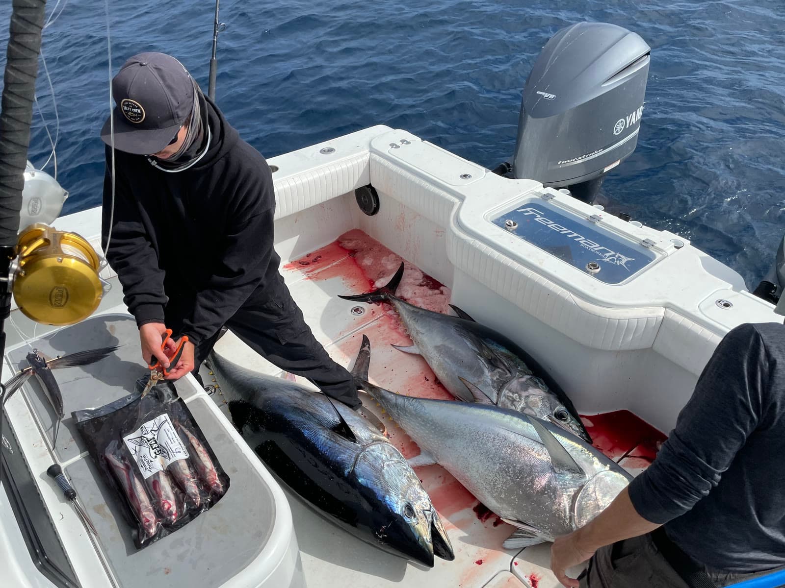
Charts in the morning. Catches by sundown.
Fresh ocean charts on your phone every three hours, around the clock. We do the heavy lifting so you can leave the dock with a plan.
SoCal Fishing Intelligence
Spotter-plane tracking and the verified-catch map ship only in the SoCal version, layered over the same temp breaks, chlorophyll edges and live fleet AIS. In the Santa Catalina Channel it put members on fish a full day before the sportboat fleet reached the same water.
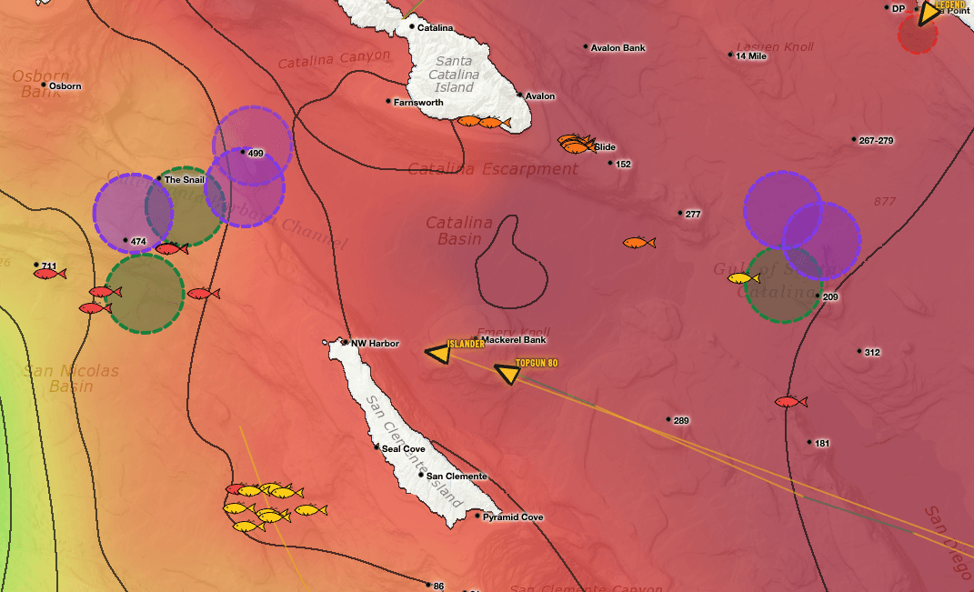
Two layers you won’t find anywhere else.
Satellite water is table stakes. These two come from people — pilots in the air and anglers on the water — and they only ship in the SoCal app.
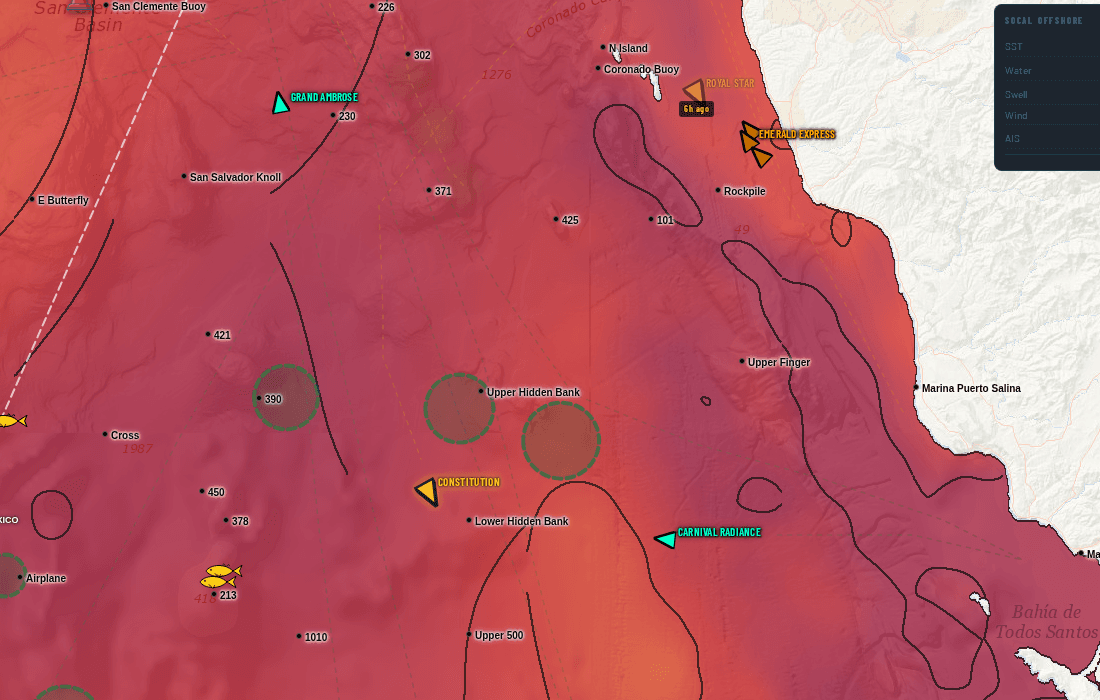
Somebody flew out and circled this water
Fish-spotting planes work the Bight every day. When one stops and orbits a patch of ocean, the pilot is looking at something — bait, breezing fish, a paddy. We track that flight activity and draw the zones they circled straight onto your chart.
On the live chart, swordfish spotters draw in purple and every other spotter draws in green, each on its own toggle — so you can tell a broadbill orbit from a tuna orbit at a glance.
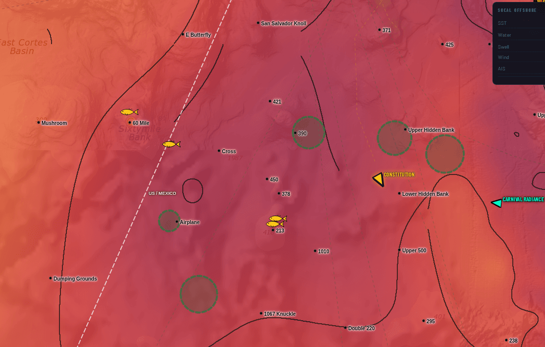
Real catches, pinned where they actually happened
Every fish icon is a verified catch plotted at its real position — not a rumour, not a screenshot of somebody's dock talk. Colour shows how fresh it is, and tapping a pin gives you species and timing.
Lay it over the temperature break and the fleet's stop circles and the pattern shows itself: the catches stack on the edges, and you can see the bite move day to day.
Spotter-plane AOIs and the confirmed-catch map are part of the Southern California subscription. They are not included in the US or International versions. See the full SoCal guide.
Stop stacking subscriptions.
Live vessel traffic. Custom watch list. 7-day playback. Buoy temps. Contour breaks. No other chart service in our comparison has all five — here they come bundled for one price.
Live vessel traffic + 72h playback
Watch your competition right now. See where they were drifting yesterday. Spot the bite before it ends.
Custom 50-vessel tracker
Your watch list. The boats you actually care about, not 5,000 commercial ships filling the screen.
Contour break overlays
Temperature breaks as crisp discrete lines. Find the edge faster, not gradient guesswork.
7-day chart playback
Scrub backwards. See where the temp break has been moving and where the green water shifted.
Live NDBC buoy temps
Real ocean temps from real buoys. Not satellite estimates filtered through cloud cover.
US + Intl coverage
PNW → NE for US. Mexico, Central America, Caribbean. One subscription, every coast you fish.
Satellite SST and chlorophyll, and on most a look back at earlier images. No live vessel traffic, so you guess where the boats are, you guess where the break moved, you spend the morning pinpointing what already happened.
Live AIS shows where your competition is right now. Your custom ring tells you the moment your watch boats stop. 7-day playback shows where the temp break has been moving. Buoy temps confirm satellite. You leave the dock knowing where to go.
选择您的水域
四个套餐,按月计费,每个套餐 7 天免费试用。可随时取消。
美国
覆盖美国所有沿海地区——从太平洋西北到新英格兰,加上夏威夷。
7 天免费试用 · 随时取消
- 8 US regions (PNW, NorCal, SoCal, Hawaii, Gulf, SE, Mid-Atl, NE)
- SST + Chlorophyll (1d / 3d / 7d / raw)
- Live AIS vessel tracking
- 958 US coastal GPS waypoints
- Vessel watch list (up to 50)
- Contour overlays & basemaps
国际
美国 + 墨西哥、中美洲及加勒比海。为长程船长打造。
7 天免费试用 · 随时取消
- Everything in US
- Mexico + Baja coverage
- Central America coverage
- Caribbean coverage
- International AIS tracking
- Priority support
SoCal
南加州专属情报——最高数据密度、船队热力图、实时渔场。
7 天免费试用 · 随时取消
- Dense SoCal SST + Chlorophyll
- Enhanced AIS vessel coverage
- 59-vessel watch list + playback
- Vessel-traffic fishing-stop heatmap (3-day)
- Spotter-plane areas of interest (SoCal only)
- Confirmed catch map — real catches, pinned (SoCal only)
- Active fishing zone detection
- Daily fishing reports
全访问 Pro 套餐
所有地区、所有功能。SoCal 情报 + 完整美国 + 国际——一个订阅。
7 天免费试用 · 随时取消
- Everything in SoCal
- Everything in US (8 regions)
- Everything in International
- Single login across all apps
- One-click region switch
- Priority support